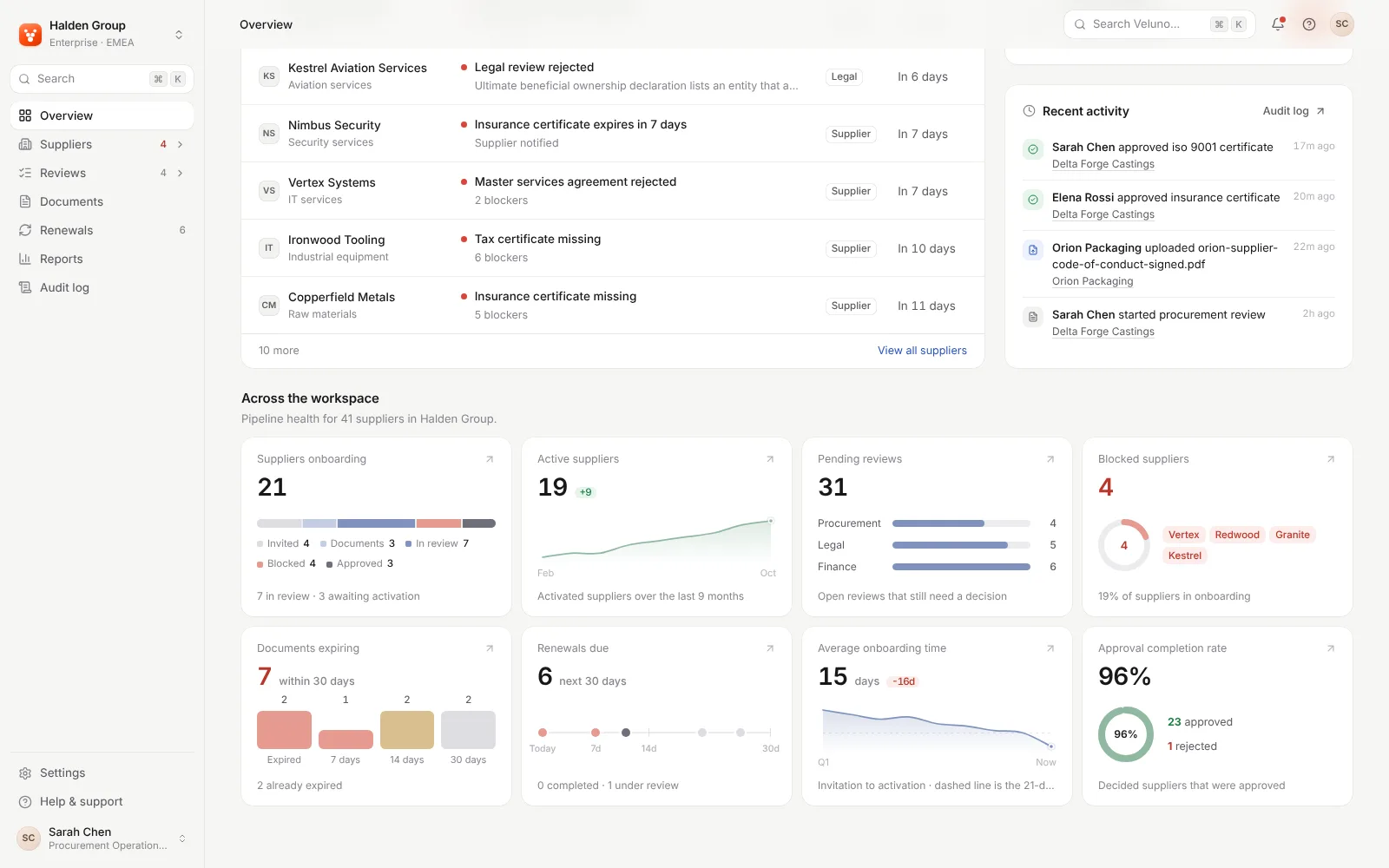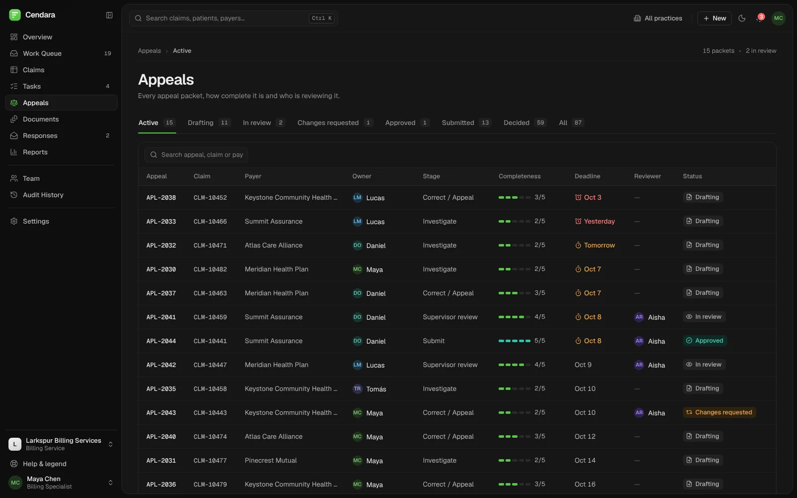


Sortie: mission control for a city's delivery drones.
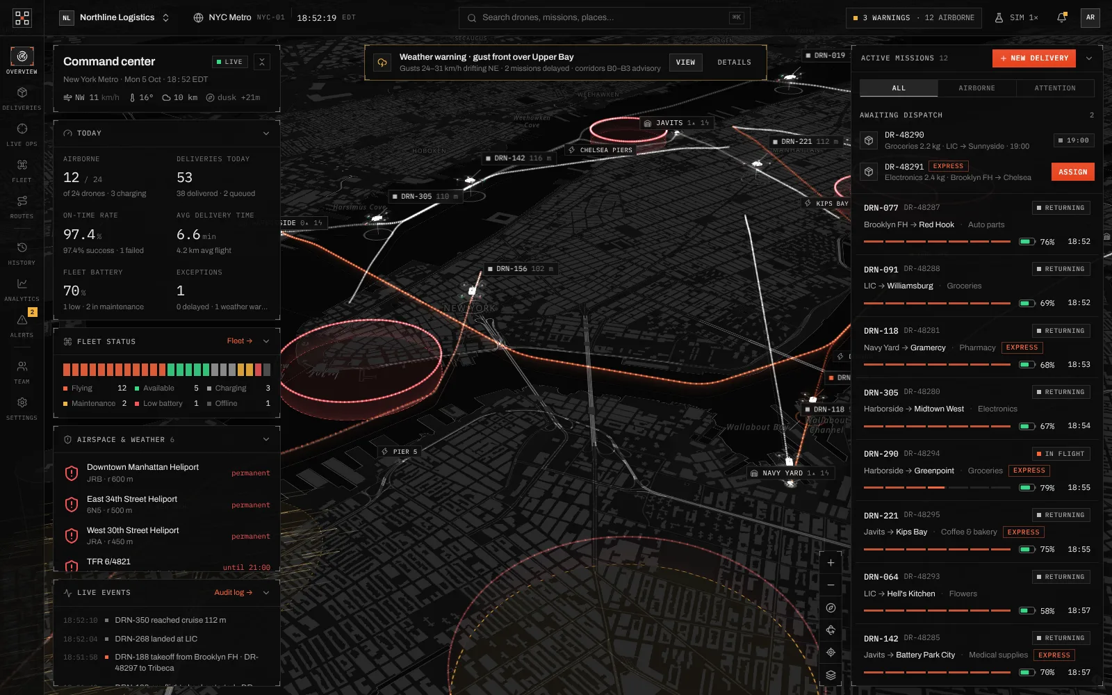
Every drone, delivery, route and alert on one live 3D map of the city, so a small team can run an autonomous fleet and step in when something needs a person.
Built by Gr8r for its own portfolio. Not client work.
- Client
- Sortie
- Project
- Drone delivery operations platform
- Platforms
- Web app, desktop
The problem
Keep a moving fleet easy to read.
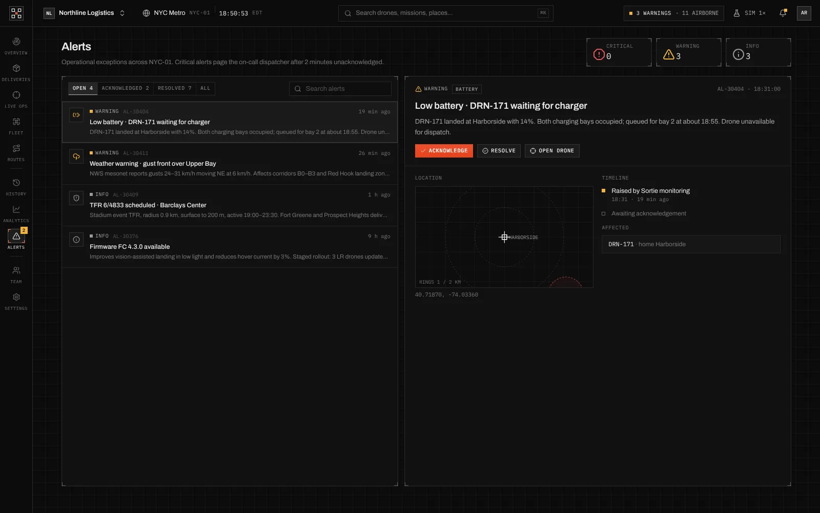
A drone delivery team watches dozens of flights at once, across hubs, weather and restricted airspace. Each flight changes by the second, and a gust front or a closed zone can affect several missions together. The product had to show the whole operation at a glance and make it obvious where a person needs to step in.
- 1Flights, weather and airspace change by the minute
- 2One problem can affect many missions at once
- 3Dispatchers need to act fast, with the facts in front of them
The workflow
From a new order to a landed parcel.
- 1
Plan
Compare routes against live airspace and weather.
- 2
Dispatch
Create the delivery and assign a drone.
- 3
Monitor
Follow every flight live on the 3D map.
- 4
Review
Replay finished flights and check the numbers.
The product
Built around the flight, not the spreadsheet.
Four areas carry most of a dispatcher's shift. Each keeps the map close and puts the detail one click away.
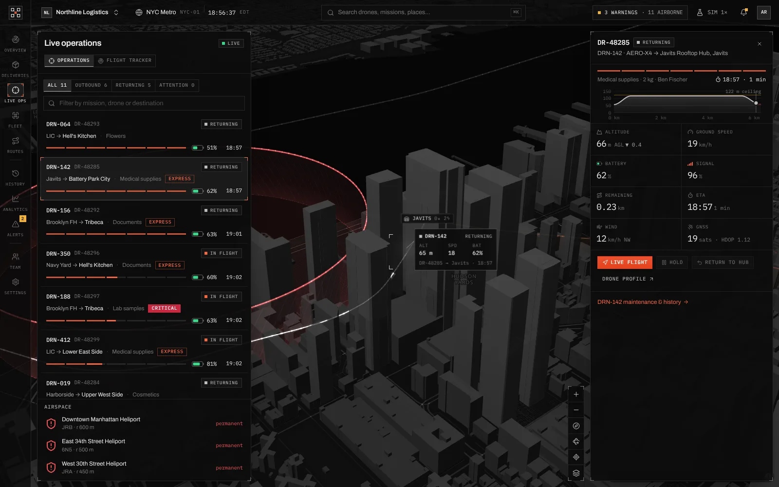
- Live ops
One flight in focus
Pick a mission and the camera follows the drone, with altitude, speed, battery, signal, wind and ETA streaming beside it, and hold or return-to-hub controls.
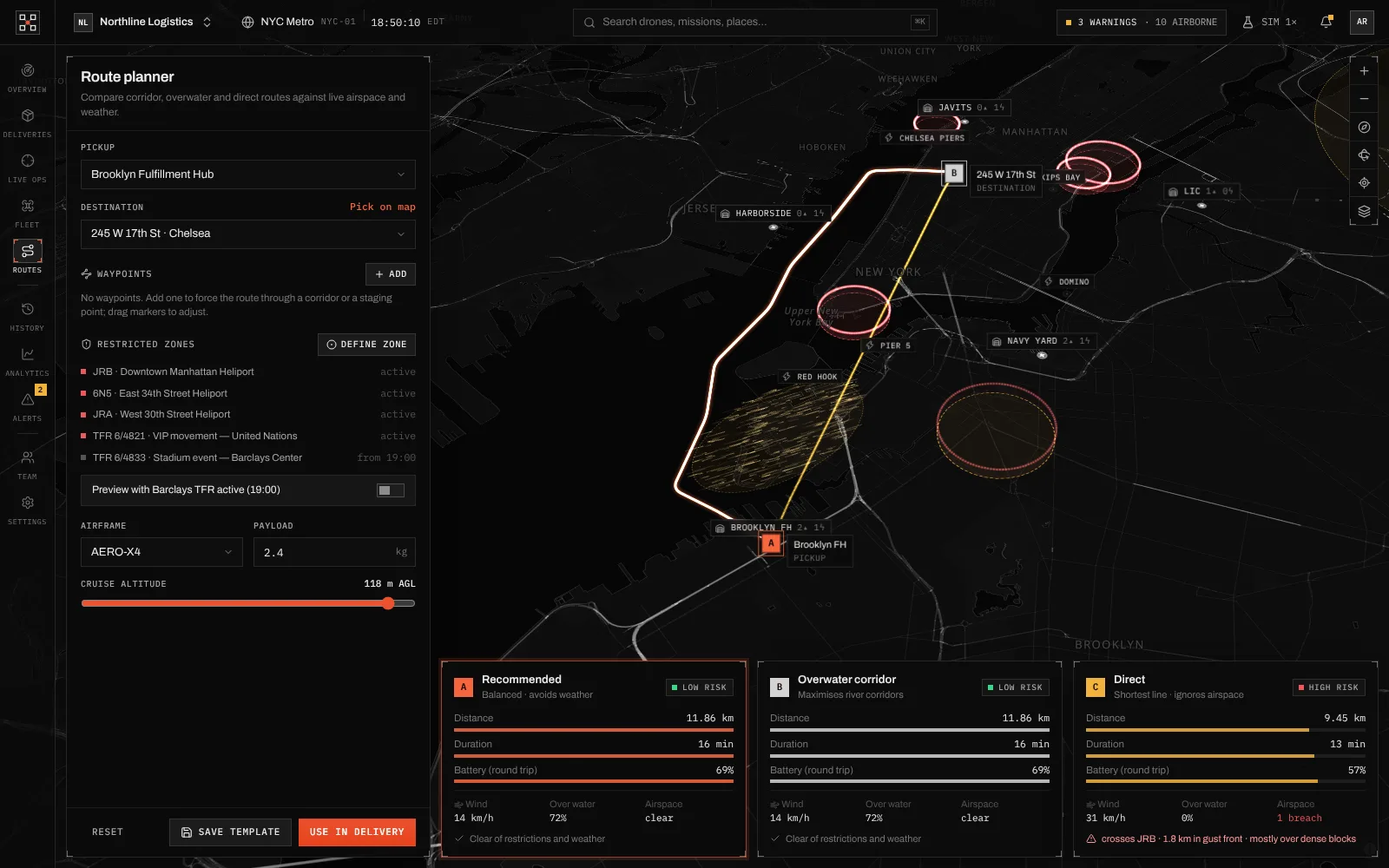
- Routes
Three routes, side by side
The route planner compares a recommended, an overwater and a direct route by distance, time, battery and risk, against restricted zones and weather.
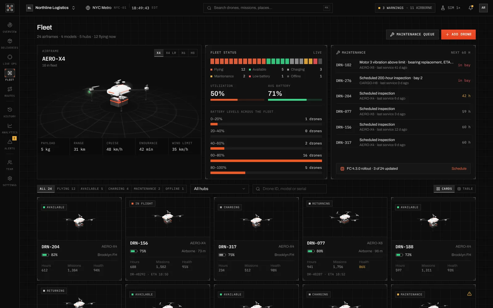
- Fleet
Every airframe and its health
Fleet status, battery levels, the maintenance queue and a card for each drone, with a 3D model of each airframe type and its specs.
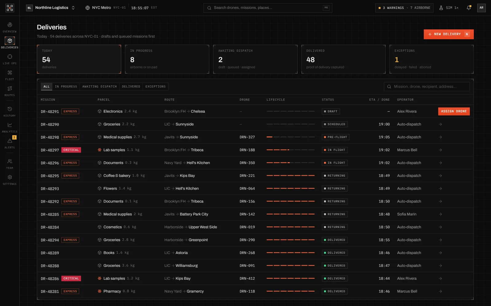
- Deliveries
Every order in one list
Drafts and queued missions come first, each with its parcel, route, drone, lifecycle progress and status, and a button to assign a drone.
Engineering
A live 3D map in the browser.
Sortie is a React single-page app. The city map is rendered with MapLibre GL on OpenFreeMap tiles, with extruded 3D buildings, restricted zones and drone routes drawn over it, and the drone models in the fleet view are rendered with three.js. A ⌘K palette searches drones, missions and places and jumps to any page.
- 3D city map with MapLibre GL
- Drone models rendered with three.js
- ⌘K command palette and keyboard shortcuts
- Search and filters on every list
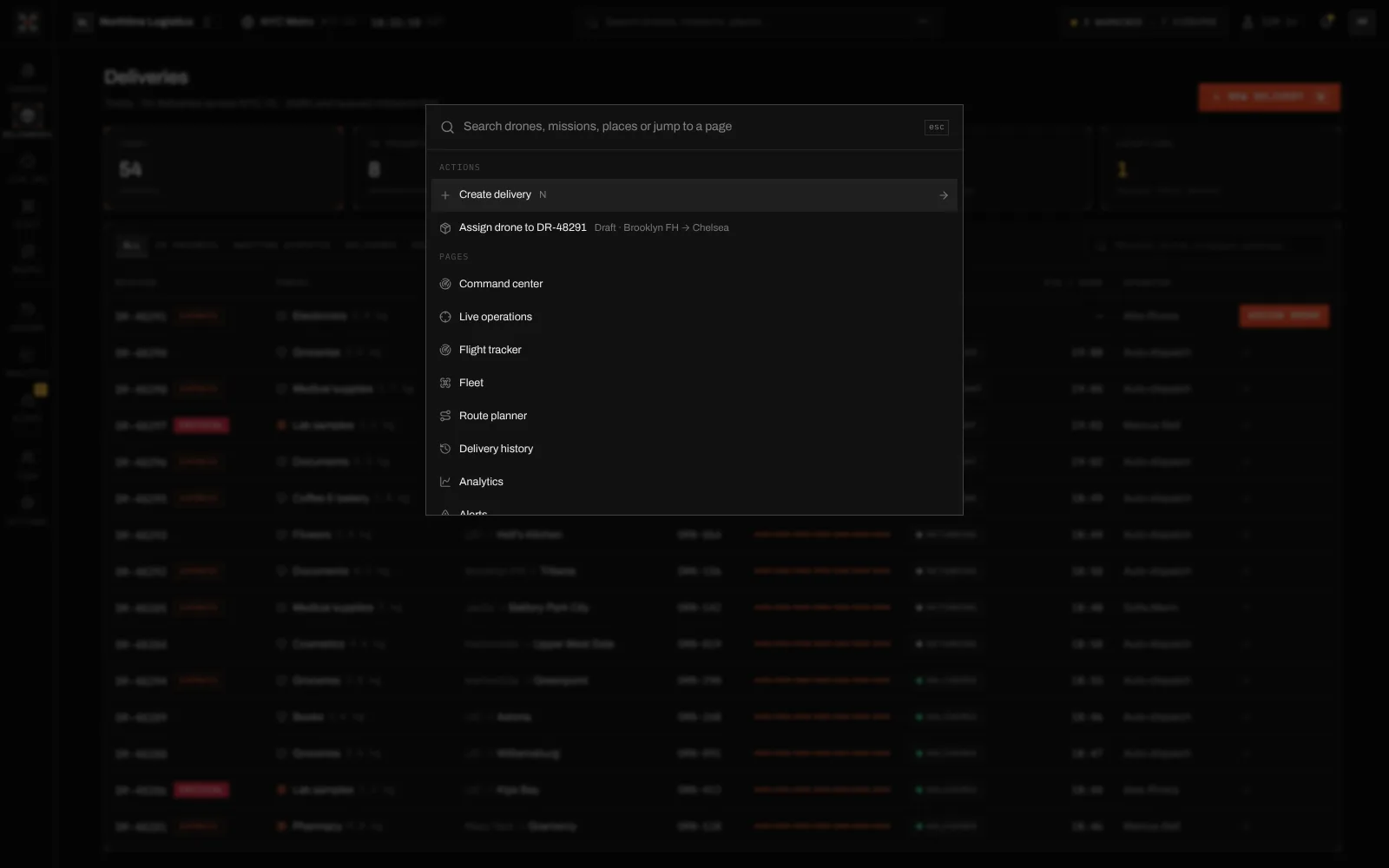
Jump: search or act from the ⌘K palette
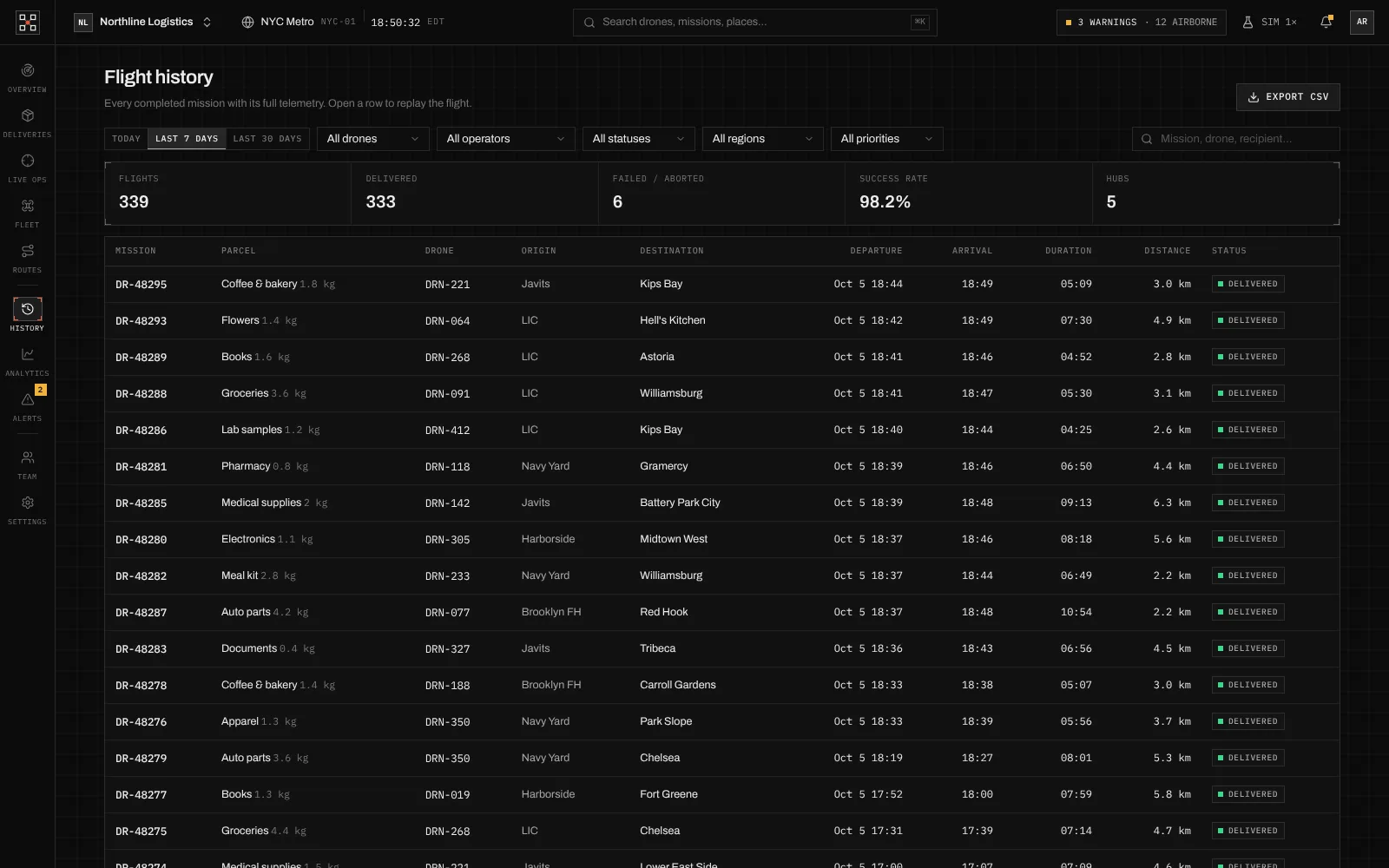
Find: filter every completed flight
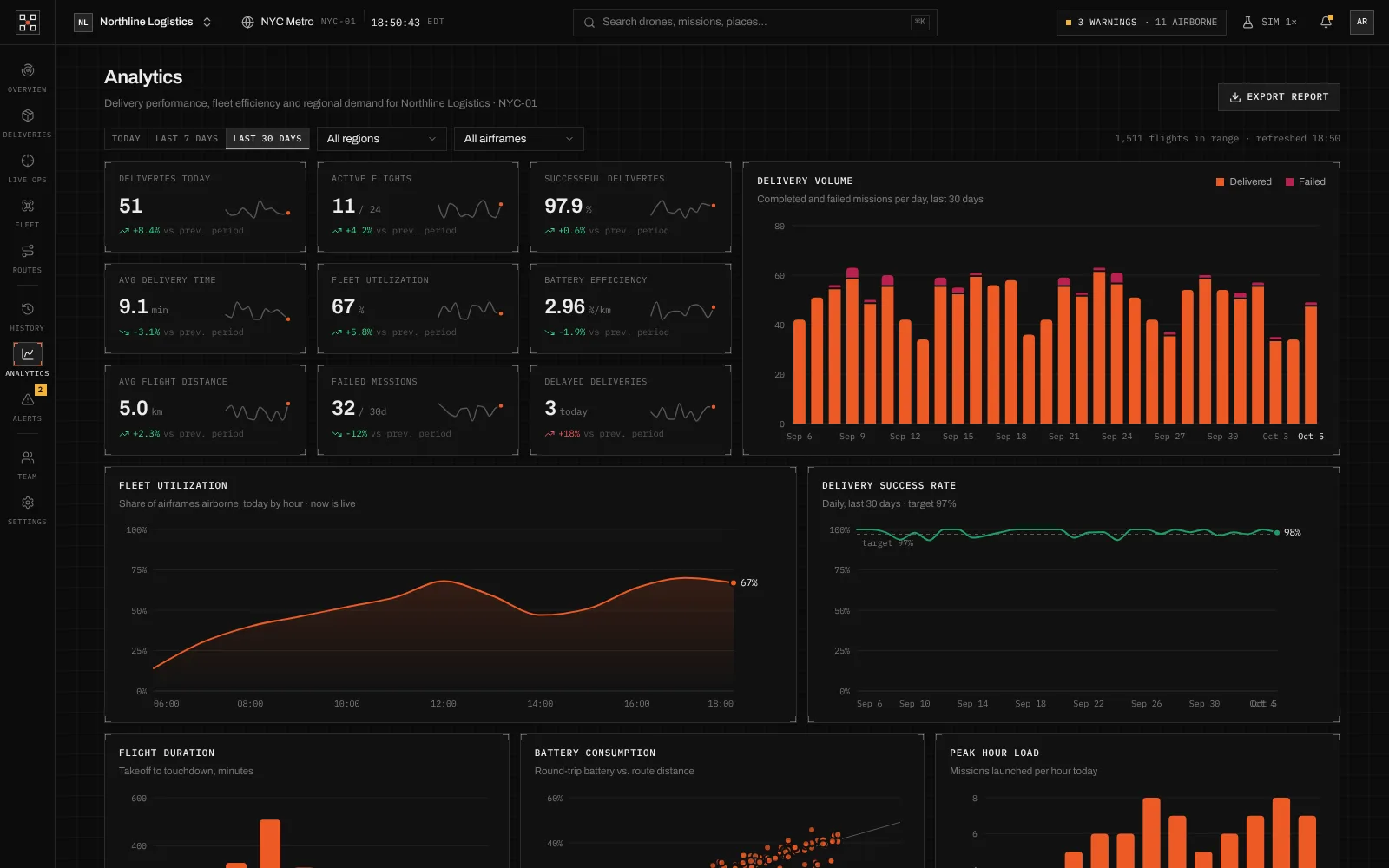
Measure: delivery and fleet performance
Outcomes
Designed for teams that run fleets, not screens.
What the product demonstrably does. Measured business results will be added only with evidence and approval.
The whole operation on one map
Drones, routes, hubs, restricted zones and weather in a single live 3D view.
Risk visible before take-off
Every route option shows its distance, battery use and airspace risk.
A person can always step in
Any flight can be put on hold or sent back to its hub from the live view.